GPS (Global positioning system)
LIMITATIONS OF THE NAVIGATION SYSTEM
This navigation system calculates the current position using satellite signals, various vehicle signals, map data, etc.
However, an accurate position may not be shown depending on satellite condi- tions, road configuration, vehicle condi- tion or other circumstances.
The Global Positioning System (GPS) de- veloped and operated by the U.S. Depart- ment of Defense provides an accurate current position, normally using 4 or more satellites, and in some case 3 satellites. The GPS system has a certain level of inaccura- cy. While the navigation system will com- pensate for this most of the time, occasional positioning errors of up to 300 ft. (100 m) can and should be expected. Generally, po- sition errors will be corrected within a few seconds.
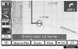
When the vehicle is receiving signals from satellites, the “GPS” mark appears at the top left of the screen.
The GPS signal may be physically obstruct- ed, leading to inaccurate vehicle position on the map screen. Tunnels, tall buildings, trucks, or even the placement of objects on the instrument panel may obstruct the GPS signals.
The GPS satellites may not send signals due to repairs or improvements being made to them.
Even when the navigation system is receiv- ing clear GPS signals, the vehicle position may not be shown accurately or inappropri- ate route guidance may occur in some cas- es.
NOTICE
● The installation of window tinting may obstruct the GPS signals. Most window tinting contains some metallic content that will interfere with GPS signal recep- tion of the antenna in the instrument panel. We advise against the use of win- dow tinting on vehicles equipped with navigation systems.
● Accurate current position may not be shown in the following cases:
• When driving on a small angled Y-shaped
road.
• When driving on a winding road.
• When driving on a slippery road such as
in sand, gravel, snow, etc.
• When driving on a long straight road.
• When motorway and surface streets run
in parallel.
• After moving by ferry or vehicle carrier.
• When a long route is searched during
high speed driving.
• When driving without setting the current
position calibration correctly.
• After repeating a change of direction by
going forward and backward, or turning
on a turntable in a parking lot.
• When leaving a covered parking lot or
parking garage.
• When a roof carrier is installed.
• When driving with tire chains installed.
• When the tires are worn.
• After replacing a tire or tires.
• When using tires that are smaller or
larger than the factory specifications.
• When the tire pressure in any of the 4
tires is not correct.
● If the vehicle cannot receive GPS signals, the current position can be adjusted manually. For information on setting the current position calibration.
● Inappropriate route guidance may occur in the following cases:
• When turning at an intersection off the
designated route guidance.
• If you set more than 1 destination but skip
any of them, auto reroute will display a
route returning to the destination on the
previous route.
• When turning at an intersection for which
there is no route guidance.
•When passing through an intersection for
which there is no route guidance.
• During auto reroute, the route guidance
may not be available for the next turn to
the right or left.
• During high speed driving, it may take a
long time for auto reroute to operate. In
auto reroute, a detour route may be
shown.
• After auto reroute, the route may not be
changed.
• If an unnecessary U-turn is shown or
announced.
• If a location has multiple names and the
system announces 1 or more of them.
•When a route cannot be searched.
• If the route to your destination includes
gravel, unpaved roads or alleys, the route
guidance may not be shown.
• Your destination point might be shown on
the opposite side of the street.
• When a portion of the route has regula-
tions prohibiting the entry of the vehicle
that vary by time or season or other rea-
sons.
• The road and map data stored in the navi-
gation system may not be complete or
may not be the latest version.
● After replacing a tire, implement the operation described in “TIRE CHANGE CALIBRATION”
INFORMATION
● This navigation system uses tire turning data and is designed to work with factory- specified tires for the vehicle. Installing tires that are larger or smaller than the originally equipped diameter may cause inaccurate display of the current position.
The tire pressure also affects the diame- ter of the tires, so make sure that the tire pressure of all 4 tires is correct.
See also:
Cruise Control
Cruise control allows the driver to maintain a constant speed without having
to operate the
accelerator pedal.
Use for highway driving or when traveling at a constant speed for long periods
of ...
Stop the vehicle immediately.
The following warning indicates the possibility of damage to the vehicle that
may lead to an accident. Immediately stop the vehicle in a safe place and contact
your Lexus dealer.
...
What types of disputes are eligible?
NCDS resolves disputes involving Lexus product reliability and warranty performance
that arise during the greater of 1) four years or 50,000 miles from the vehicle’s
in-service date, whichever i ...